T4D DAKFLOW Drone-Based Traffic Monitoring
Location : Senegal
Problem
Like the majority of growing African cities, Dakar struggles with chronic traffic congestion, especially along main commuter corridors, where peak-hour travel times were observed to exceed off-peak averages by more than 100%, contributing to reduced safety, substantial economic losses through productivity and fuel costs, and increased CO₂ emissions with associated impacts on air quality, public health, and climate. Existing data for traffic management is fragmented across agencies, often manually collected, and not systematically shared. This makes it hard for authorities to design evidence-based interventions. At the same time, past externally driven projects have eroded trust, creating reluctance to adopt new technologies. The result is a city losing millions annually in productivity and fuel, while facing rising emissions and worsening air quality. The project targets urgent needs identified by Senegal’s urban transport authority (CETUD) and local stakeholders: reliable, high-resolution traffic data, integrated datasets, and transparent governance to support evidence-based mobility planning.
Challenge
Provide reliable, high-quality mobility data in a way that is transparent, trusted, and locally owned.
Solution
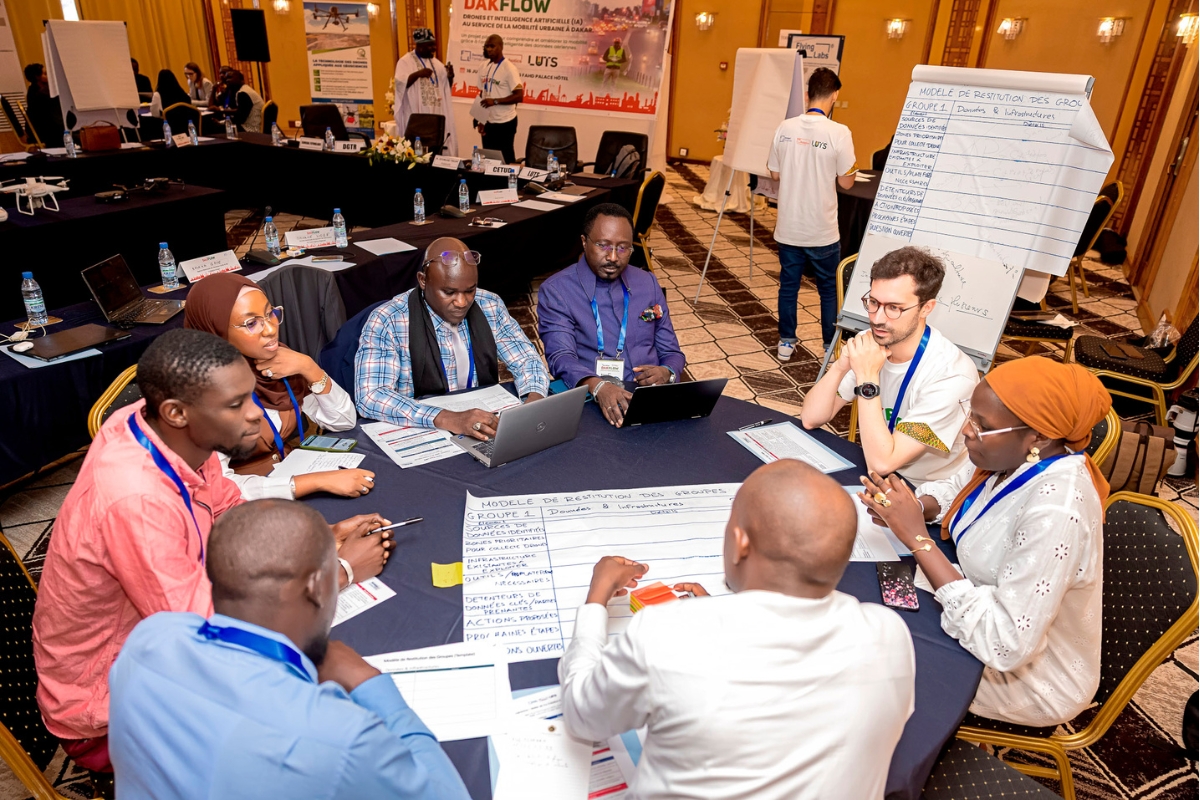
DAKFLOW proposes to use drones to collect high-quality mobility data and apply AI-driven analytics to understand congestion hotspots, modal shifts, and road safety risks. This solution aims to create open, shareable datasets of inclusive, privacy-friendly mobility patterns to support evidence-based urban mobility planning in Dakar. This encompasses generating high-resolution, multimodal traffic data, integrating fragmented datasets, and establishing transparent governance to ensure trust and equitable access, while building local capacity for sustainable operation. At the same time, the project will lay the groundwork for a platform that will be able to offer a holistic view over the city's scarce datasets.
The solution builds on the capacity of local institutions, with Senegal Flying Labs as a key local actor in Senegal’s drone and data ecosystem, working with most stakeholders to promote the sustainable use of drones and data for decision-making, and advocating for their integration in planning and development. Local operations will be led by Senegal Flying Labs, supported by EPFL’s expertise in urban mobility analysis and WeRobotics' “Turning Data into Action” methodology. It will deliver open, shareable datasets that can directly feed into CETUD’s transport planning and Senegal’s Sustainable Urban Mobility Plan.
Impact
The DAKFLOW project, leveraging AI, drone videography, and geospatial data, aims to deliver significant social, economic, and environmental impacts in Dakar.
- Socially, it will enhance mobility conditions, improving daily commutes and safety for Dakar’s 3.2 million commuters, particularly low to middle-income groups reliant on informal transport. By providing high-quality traffic data, DAKFLOW empowers local authorities to make evidence-based decisions, aligning with Senegal’s 2050 agenda for smart urbanization and digital transformation.
- Economically, optimized traffic flows will reduce travel delays, cutting productivity losses and fuel costs estimated at millions annually, boosting logistics efficiency and economic competitiveness.
- Environmentally, reduced congestion and idling times will lower CO₂ emissions, supporting Dakar’s sustainable urban mobility goals and contributing to cleaner air.
- Globally, DAKFLOW aligns with SDGs 3 (Good Health and Well-Being), 9 (Industry, Innovation, and Infrastructure), 11 (Sustainable Cities and Communities), and 13 (Climate Action) by offering a scalable model for data-driven urban planning in fast-growing cities, particularly in the Global South, addressing universal challenges of congestion and emissions.
Team members
- Prof. Nikolas Geroliminis, Principal Investigator, Urban Transport Systems Laboratory (LUTS), EPFL
- Dr. Manos Barmpounakis, Postdoctoral Researcher, Urban Transport Systems Laboratory (LUTS), EPFL
- Jasso Espadaler Clapés, Project Manager, Urban Transport Systems Laboratory (LUTS), EPFL
- Sonja Betschart, Co-Founder and Strategic Lead, WeRobotics
- Mfon Victor Udeckukwu, Project Lead, WeRobotics
- Klaudyna Kaja Wrochna, Technology and Methodology Specialist, WeRobotics
- Dan Muniu, Communications Officer, WeRobotics
- Michelle Korir, Communications Officer, WeRobotics
- Peter Martinez, Monitoring, Evaluation and Learning (MEL) Specialist, WeRobotics
- Tiamiyou Radji, Director, Senegal Flying Labs
- Olivier Lea, Head of Operations, Senegal Flying Labs
- Dr. Nicolas Poussielgue, Director General and CEO, Dakar Institute of Technology
- Dr. Taylor Mordan, Senior Computer Vision Engineer, MobiLysis


T4D Sustainable tarpaulins for emergency shelter

T4D Computational Design for Resilient Shelters